S
640 x 480 px
FREE
M
1920 x 1440 px
FREE
L
4032 x 3024 px
FREE
Upgrade to download up to 10 images at a time.
Standard license
This [Yamaniya] Takamatsu city area photo can be used for personal projects. It can also be used for commercial projects in some cases. Read more
Image information
المنشئ:スターゲイザー☆2501
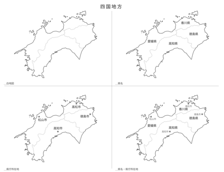
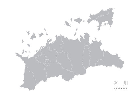
Title: [Yamaniya] Takamatsu city area
Image ID: 26904047
Downloads: 0
Model release: N/A
Property release: N/A
Categories:
المباني-الهندسة-المعمارية / [Yamaniya] Takamatsu city area
طبيعة-المناظر-الطبيعية / [Yamaniya] Takamatsu city area
طبيعة-المناظر-الطبيعية / [Yamaniya] Takamatsu city area
![[Yamaniya] Takamatsu city area, مدينة تاكاماتسو, مقاطعة كاغاوا, أودون, JPG](https://thumb.photo-ac.com/10/10c4862d382a74555af2962972075444_t.jpeg "[Yamaniya] Takamatsu city area, JPG")
0
Share
Like
Antivirus
S
640 x 480 px
FREE
M
1920 x 1440 px
FREE
L
4032 x 3024 px
FREE
Upgrade to download up to 10 images at a time.
Standard license
This [Yamaniya] Takamatsu city area photo can be used for personal projects. It can also be used for commercial projects in some cases. Read more
Image information
المنشئ:スターゲイザー☆2501
Title: [Yamaniya] Takamatsu city area
Image ID: 26904047
Downloads: 0
Model release: N/A
Property release: N/A
Categories:
المباني-الهندسة-المعمارية / [Yamaniya] Takamatsu city area
طبيعة-المناظر-الطبيعية / [Yamaniya] Takamatsu city area
طبيعة-المناظر-الطبيعية / [Yamaniya] Takamatsu city area
Similar free stock photos
View all
Similar free illustrations
View all


Similar free illustrations
View all Comments
Login or Sign Up to leave a comment